Mileage: 90
Total mileage: 3774
Total mileage: 3774
It seems the hills aren't going to stop for a while!
This morning at the diner in Halfway, the waitress wasn't taking me seriously. She insisted that no one could want eight eggs AND a stack of pancakes. I assured her that I knew what I was ordering, and her repeated gesturing of the size of the pancakes wasn't dissuading me. I've had this same breakfast for the past 3 days in a row and not had any trouble finishing, so I included a picture. Doesn't look unreasonable, does it?!

I was glad that I fueled up, because the morning started with a punishing 1000 foot climb over into Richland. From there I dropped back into Hell's Canyon for the next 30 miles or so. I knew from the elevation profile on my maps that I was supposed to spend my morning almost exclusively climbing, so I was bewildered as I continued to descend gently in the canyon along the river. In fact, it started to become frustrating because the wind was blowing in my face and despite the gentle downhill slope I was making terrible time. After a few frustrated miles I pulled over and stared at the Powder River for a while which was flowing next to the highway. Oddly, it was flowing towards me, meaning I was going upstream. I looked back at the road and there was a really weird optical illusion, like when you look at that picture with the boxes coming out at you and suddenly they flip so that they're going back into the page. The gentle downhill slope had become an uphill slope! It was very strange. You'd think I'd be able to tell if a road was going downhill or up just by looking at it, but the lay of the land and apparently some expectation of going downhill was enough to fool my mind. Suddenly, even though I was going the exact same speed as before, I felt very satisfied with my pace and the frustration evaporated.
As an aside, I think that this is where the frustration of the wind comes from. It's very mentally challenging when the look of the road in front of you doesn't match the speed you're traveling. 15 mph feels great on a gentle incline and it's absolutely terrible on a descent. Perhaps this is also why it helps so much to stare at the handlebars while climbing!
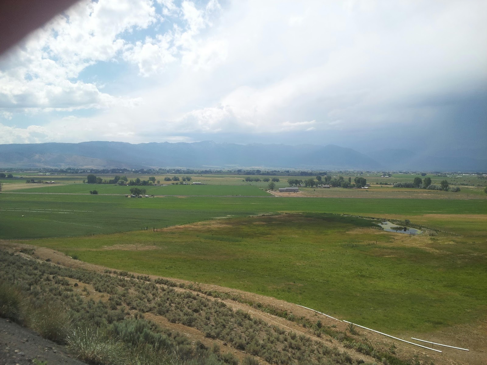
My morning ended with one last climb out of the dry and barren desert...

...and over the hill, down into the lush Baker City Valley.
As I sat down to lunch in Baker City I took my phone off airplane mode and got a text from a family friend back in Arizona, Kirk Hayes. It said something like, "You might soon be going through my hometown of Baker City." After a short conversation he told me that his parents were actually in town and gave me phone numbers and addresses in case I wanted to stay the night. I was hoping for some more mileage, but mentioned I might stop by to say hi.
After lunch, I was sitting on a bench in the city outside the (closed) bike shop, getting ready to text his family that I wouldn't be able to see them before I left, when a couple walked up and asked if I was "the young man with the bike." By sweet serendipity I had run into his parents on the street. I forgot to get their picture, but we chatted for a bit and they gave me valuable information on where I could find water this afternoon.
My goal for tonight was to get to Austin Junction, a total of 103 miles. Due to all my climbing and lollygagging in town, I figured I was going to run out of daylight. Out of Baker City I had a 25 mile slow ascent into three steep 1000 foot peaks in rapid succession. I started the first climb as the sun was going down, after chugging 2 full water bottles that I filled up at a convenient ranger station. I used the last of my phone battery to get two quick pictures.


Sadly, I should have saved some battery for when I got over the first peak. I'll have to describe the panorama instead. As I descended from the summit of Sumpter, there was a flaming crimson line settling over the mountains on my right. Circling around the perimeter of the sky was a delicate spread of light, feathery clouds dipped in a gentle peach glow from the setting sun. I could see the entire 10 mile length of the valley between my current descent and my next climb where the densely forested ridges faded down into soft mountain meadows with a bright blue river glimmering through the middle of them. Tiny black dots of cattle were spread across the landscape, enjoying the idyllic seclusion. While I rode through the valley and made a westward turn, the crimson line settled down into a gentle layering of red, orange, violet and finally grey, sitting on top of the mountains ahead of me. It bathed the whole landscape in that soft amber glow that can make almost any view look romantic.
I figured I had about 45 minutes of daylight to cross the valley and make the last climb before I'd do my descent into Austin Junction in the dark. As I was zipping along the valley floor, I started to wonder why I was bothering to zip by. There was nothing particularly special about Austin Junction, except a little country store where I might get electricity overnight. It seemed truly criminal to waste that kind of gorgeous scenery by riding through in a haze of exhaustion, so I pulled off the side of the highway as the sun finished sinking over the horizon. There's a nice little hill here, all covered in pine needles and overlooking the pastures below. I've laid out my groundcloth and sleeping bag and this is looking like a great place to spend the night. I'll get up a little earlier tomorrow to sneak those last 13 miles in before breakfast.
Hopefully the logging trucks wake me up a few times as they go by tonight, I'm really hoping to enjoy the stars. G'night!
No comments:
Post a Comment